|
|
Start of segment 5 at: Badlands National Park, Interior, SD to 301 East E St, Casper, WY
|
|
City Maps: Badlands National Park, Casper
|
|
Step
|
Directions
|
Elapsed
Distance
|
|
46
|
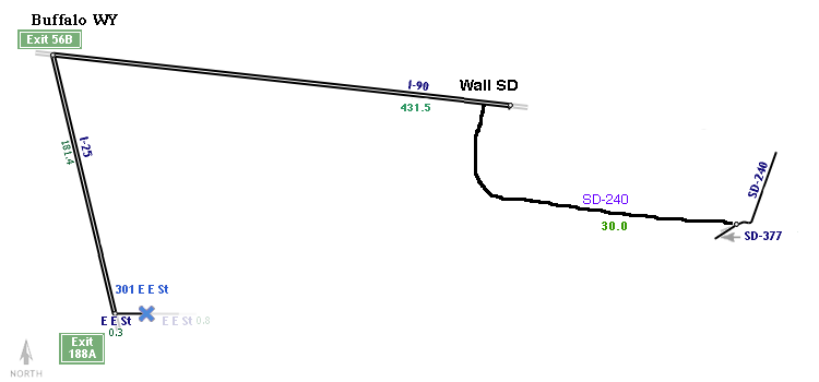
Bear left on SD-240,Badlands Loop and go Northwest for 40 km
|
2264.6
|
|
47
|
Turn left on entry/exit road at sign reading "I-90 W" and go West for 400 m
|
2265.0
|
|
48
|
Bear right on I-90 and go West for 431 km
|
2656.0
|
|
49
|
Exit I-90 via entry/exit road at sign reading "Exit 56B I-25 S / US-87 S to Casper" and go 800 m
|
2695.9
|
|
50
|
Continue on I-25,US-87 and go 180 km
|
2875.8
|
|
51
|
Continue on I-25,US-87,US-20,US-26 and go 1500 m
|
2877.3
|
|
52
|
Exit I-25,US-87,US-20,US-26 via entry/exit road at sign reading "Exit 188A to Center Street and I-25-BL / US-87 Business" and go 200 m
|
2877.5
|
|
53
|
Continue on E E St and go 300 m to 301 E E St
|
2877.7
|
|
PREV
|
End of segment 5; (5 hours and 46 minutes and 653.2km)
|
NEXT
|